Our next bike adventure was up the infamous “Amasaback,” A steep and narrow grind up a few thousand feet of vertical starting from the Colorado River and finishing atop a huge mesa overlooking Canyonlands National Park.
Above: Another sign designed to scare you off. The trail winds up over Suz’s head if you can believe it.
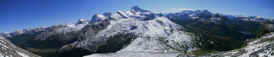
Above: Suz, at the top of some hard won elevation, enjoys the view a couple thousand feet down. Scale up here is pretty mind numbing as you are looking 20km to the other side of the canyon! Needless to say, the ride down was pretty exciting and a bit white knuckley. Didn’t get any downhill shots and was wishing I had a bike-mounted camera.
Next up was a hike in to Corona Arch, a few kms up from the Colorado River. Below, Suz climbs up a short, bolted cable section that protects you up a series of cliffs. 

Above: Suz in yellow gives a sense of scale to the alien landscape. This arch is really massive and in a beautiful setting. The next day we did some quick hikes in Canyonland National Park just west of Moab. Click the picture below for a better look. The spot in the photo below is at Islands in the Sky, Utah. My vote for most evocatively named area ever.

You can stare at it for an hour and it still doesn’t make sense. For the curious, there is 8800 vertical feet from the top of the mountain to the Colorado River deep in the canyon! To satisfy my geological curiosity, we hiked into upheaval dome, a geological mystery. An odd place with a strange beauty.
One of the places we had researched and wanted to explore was Goblin Valley in the San Raphael mountains on the way to Capital Reef National Park. It didn’t disappoint and being off the beaten path, we had the place to ourselves.
Above: The rocks in Goblin Valley look as though a fortress and defending army have been turned to stone, then melted, then blasted by centuries of desert sand. 

Above: Wandering through the maze of rock blobs. Click on pics for expanded views. I mentioned before how Utah’s landscapes appear to have been made by giants. This place seemed like it was built by giants and destroyed by dragon fire. It’s also possible that if you wander through here long enough, you will find a bus-sized blob that looks exactly like your own nose. We spent the afternoon but couldn’t find ours so I can’t verify that.
We continued on our way west into Capital Reef National Park, setting up our tent in Fruita, Utah, population a dozen plus 3 horses. I’ve had the tent set up in some nice places, but this was ridiculous. Our camp was in an orchard with white apples blossoms in contrast to the pink, orange and red cliffs, with Fruita’s three horses grazing in the corral next door.
Above: The view from our tent vestibule! Fruita is an old Mormon colony now a historical site. What’s better than camping in a grassy orchard? The farmhouse just out of frame sold us some homemade cinnamon buns for breakfast in the morning! I think I could live in our 6×4 tent on that spot for a few decades!
Above: Cottonwood trees stealing water from Fruita’s creek just down from our tent. The spring buds gave a hoar-frosted look to them. Amazing contrast with the late sun striking the rocks. No colour adjustment was done to this picture. The fact that the creek has running water in it makes this valley unique in southern Utah where most creeks are dry until rain events. The backroads don’t even build bridges, they merely pave the road right through the creekbeds making them impassable when it rains. It does prevent them from having the flash floods destroy them a few times a year.
In Capital Reef, our objective was to climb Navaho Knob, a 3000 foot vertical climb to gain a view of the “Waterpocket Fold” and the surrounding area.
 Above: After some steady climbing, the route traces the edge of this cliff for almost a kilometer before the final climb on a Navaho Sandstone tower. From the top we could clearly see Mt Peale near Moab, a distance of over 180kms! I keep a strange database at home of what you can see from where in the Rockies. This one took the cake.
Another excursion we made was into Grand Wash canyon. We were just exploring and in the canyon there was a sign for “The Tanks.” It seemed as good a thing as anything and the timing was about right. Not knowing what the tanks was supposed to be, I had it in my head that it was a big rock feature. After climbing up a side canyon following some rock cairns, the tanks turned out to be water tanks. Deeply carved out pools that would hold water from the storms. I learned later that once upon a time, donkey trains would come up here for water. Butch Cassidy and the Sundance Kid also hid out in these canyons and apparently came here for water. Certainly, if you had never been here before, you would never stumble upon it by chance given the convoluted terrain.
Capital Reef also gave us a great light show. We climbed up to the aptly named Sunset Point to take in the show.
Above: Perfect light on Navaho Knob, the previous day’s climb.
At this point, our senses were getting overdosed and we would be going to Bryce and Zion in the coming days. Thanks to Fruita Valley for raising the bar on perfect tent spots and giving me two great sleeps in the bargin!

