Prologue.
The Grizzly Ultra is 50km long with a vertical gain of 1700 vertical meters. In layman’s terms its like running up and down a 10 story building every single kilometer for 50 kilometers. To train for a race like this involves quite a bit of time to gradually work up to that distance and elevation gain. As I am away working up north and unable to train long enough, I had to make up my own compressed training schedule and hope for the best. My goal was to finish with dignity but just deciding to try something this hard and committing to the work is reward enough. For simplicity I’ll do this post in time stamp format.
Aug 2014. Suzanne suggests going for a run with a new group called Canmore Trail Culture. I ran 7km on the Loki trail with them and had a great time trying to keep up but many runners stayed at the back with me and encouraged me.
Sep-Oct 2014. Tuesday with CTC becomes a regular night for me and I make sure I am well prepared to be at my best for their runs. I’m quite pleased to discover on the CTC update info page that I’m earning a reputation as someone who shows up every week no matter the weather!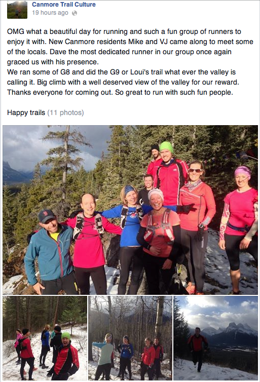
Above: On this run I chatted with a woman who runs 300km races. I learned plenty about running just listening to the conversation from these runs.
Nov 2014. After a couple bigger runs I start to feel more comfortable with my abilities and after hearing the many tales of races from other people in the group I decide kind of without thinking too much to sign up for the Grizzly Ultra-marathon.
Spring 2015. After the snow melts I get running again knowing I have to go to work soon and will be unable to train. At work I am walking long distances through rough ground every day but I’m hoping I won’t lose too much fitness.
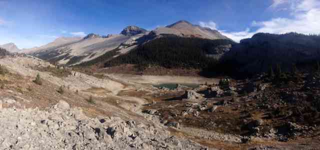
Aug 2015. After recovering from work and letting the smoke from forest fires abate, I start training with 7 weeks until the race. The course is on the trails at the Canmore Nordic Centre so I do all my training on the course learning every climb and corner.
Oct 1 2015. My daily run is up to 20km with 400m elevation gain but my longest run I get up to is “only” 26km with 500m elevation gain. I’m a bit worried as my ankle starts to hurt a lot after 20km.
1 week to go. I taper for a week running only small amounts and mostly resting and eating. I up my protein intake to over 120g per day to help repair muscles from hard training.
5 days to go. I go to the Tuesday Trail Culture run and share my nervousness with the others. There are ten of us from our group entered so its our last week to compare aches and pains and encouragement. I run behind Emily who just returned from a 160km race in Oregon. I ask plenty of questions and get plenty of advice.
Night Before. I look at the weather forecast and figure out what clothing combinations I might want. I organize my equipment, water bottles, nutrient gels, mandatory bear spray, clothing etc. I toss and turn for a few hours and fall asleep around midnight. Suz pretty much leaves me alone that day as I was too nervous and fidgety to make good company! I lay in bed going over all the things I want to remember:
-stay calm, don’t start to fast with all the excitement, stay hydrated, don’t fall behind with nutrition, have some go-to happy thoughts if you start getting negative, etc etc etc
Race Day! I get up at 6am and eat some easy to digest food and some hydration salt-laced fluids. The course route is shaped like a flower consisting of 5 different loops that start and end at the Nordic Center. This allows you to always be coming back to a central location where you can have a base station with your foods, drinks, clothing and support people. Suz leads me through all the preparations as I seem incapable of the details of the moment.
10 minutes to Race Start. The Trail Culture runners get together for a group picture.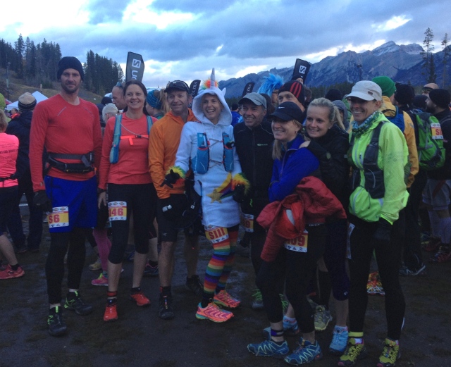
Above: Feeling nervous but Stephanie in her unicorn warm up suit(!!) helps everyone relax! Many runners use lightweight vests to hold water, bear spray and food while others like me used belts. Solomon footwear is definitely the unanimous choice.
Sunday Oct 11, 2015 9:00am 7 degrees, wind gusting to 40km/hr
deep breath….
I’ve had plenty of epic days and events in the wilds. These tended to sneak up on you and you would find yourself dealing with them without having had much time to think about it. I had been thinking about this for 11 months. Now the moment arrives and I’m so worked up I find I can’t really think at all. The world is unfolding in front of me while my inner thoughts are stuck in a stammer trying to catch up to the unfolding present rather than the imagined future that preoccupied it for the last few months. Remember not so fast. I use my mnemonic device: “Too fast, Vasily. Too fast. Those charts are laid out precisely… so many knots at such and such a course for so many seconds. ” It’s line from the submarine chase in “The Hunt for Red October” and it seemed very appropriate to me as I laid out in training how to run each kilometer of the course. As the throng of runners leaves the start line I mutter it again, “Too fast Vasily.”
I run past Suzanne cheering at the start line and head out with 290 fellow competitors in the Solo Category.
Leg One: 14km, 309m vertical climb
I enjoy this part. I trained this section a lot as I wanted the start to be like a comfortable friend. It’s not very demanding technically and is a wide trail which allows everyone to pass and find their place. It climbs up to an open meadow and gives great views of the Bow Valley. I’m trying to do this section in one hour 40minutes ish. Time back at the Nordic Center is 1:37. A group of people from Trail Culture came out to cheer us on and the sound of cowbells and cheers from familiar faces feels like a shot of adrenaline! I stop for 20 seconds at my feed station for some carb gel, refill my water and ditch my gloves. 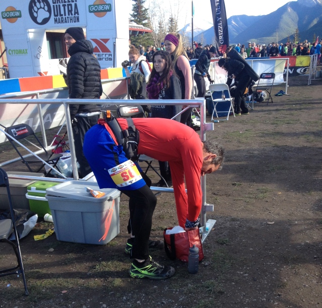
Leg Two 12km 385m vertical climb
Leg two starts with a long climb for the first 2km so it was a wonderful surprise to see some friends at the top of the hill with a cheer and a “high five.” Suz went for lunch with my blessing as I didn’t want her to stand around for the first couple legs only to see me for half a minute. She was going to come back for the last stages when I thought I would really need the emotional support.
At this point I was feeling very good but impatient. Stage 3 is just a brutal grind that lies in wait to break you. Most runners will start to feel some pushback after 26 kilometers which is right when this course starts to get mean. At the moment though, I was still 12km from this thing. I felt like I was in a very long lineup to face a firing squad.
Halfway done stage two and just over 20km into the race and feeling good. I can’t wait to finish this stage because then I’ll be on stage three and if I can do that then it’s really just dotting the t’s and crossing the i’s. Or so I imagined. I thought that Stage 3 would be the epic physical challenge and then once I got to Stage 4 I would be sort of out of body, glazed eyes, watching my body on auto-pilot, the end is close, I can’t feel anything anymore, muscle memory grind to the end.
I suppose the same logic could convince you on Tuesday that tomorrow is Sunday since it’s almost wed which is really thurs which is a day from Fri and that’s the weekend. I’m sure this is familiar to everyone! But I was still on Stage Two.
At km 26, I emerged from the forest with the Nordic Center below me and the sound and the noise once again lifted me up. The cheering section was still there. Another round of nutritional gels, refill my water, a glass of hydration fluids and some vegi sticks and off to stage 3! Out of 290, I was in 223rd place not that I cared in any way.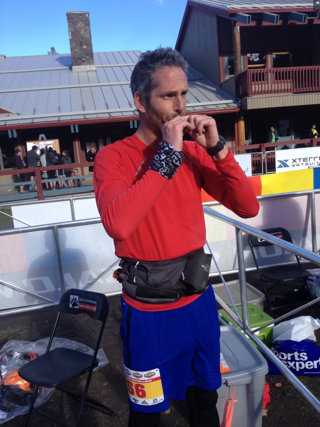
Above: Quickly downing a gel at the feedzone.
Leg Three 12km 510m vertical climb
I took another big breath, closed my eyes and clapped a few times. Here is where it all begins. The first couple kms are easy but at km28 of the race, the trail dives straight down into some nasty cliffs, rocks, roots, streams, hills and 20 kilometers of torture. Two kms into the stage a woman asks me how I’m doing. “I’m so excited!” I reply. She sounds surprised and asks why. I tell her that this next stage is really, really hard and I can’t wait to see what its going to be like to take it on. She seemed to like that answer, “Right On!” she said sounding reenergized and gave me a high five.
I ran this stage a lot in training. I didn’t want the hardest stage to be intimidating. I wanted to look forward to it. After 30kms there is no way to make it easy but I hoped training hard on it would take some of the fear out of it.
That’s when something surprising happened. I kept waiting for my ankle to start hurting. Instead my illiotibial was slowly morphing from a mild notice in stage one to a bit of a thing in stage two and now suddenly an angry dragon here in stage three. Iliotbial problems manifest as a pain behind the knee and a direct result of a compressed training schedule.
It was really making me angry that I was feeling energetic here on the part of the course I looked forward to but being thwarted by pain. I started to walk. Everyone that passed me either asked if I was okay or merely just understood the situation and offered a “you’re doing great” or a “keep at it.” Getting down the steep parts were a killer as bending my left knee was excruciating. I went down sidestepping with my good leg on the downhill side. I was already thinking how I was going to console myself for being unable to finish. After a kilometer of limping, I came across a guy stretching just off the trail. I asked if he was okay. He said his hamstrings were going but he wasn’t going to give up. “Got to just keep walking.” he said. We hobbled together for about 15 minutes chatting. This was his 7th ultramarathon so he told some stories. I noticed as the race got deeper and everyone starts to struggle, the racers all get chatty and talkative. Everyone needs to take their mind off what ever hurts. My new friend wished me luck and ran off.
With just another kilometer before the Nordic Center, a fellow competitor came up behind me and asked if I was okay. “It looks like your I.T. is gone eh? Here take this!” She took 2 ibuprofins and a tylenol out of her vest and gave them to me. “Give it 20 minutes and you’ll be feeling better.” I thanked her and she took off.
I was still unsure if I would keep going but at least I wasn’t decided that it was over. Then, with great timing, my magic unicorn appeared! Actually it was fellow Trail Culture buddy Stephanie with her rainbow coloured tights. She was so far ahead, she was about to finish and our paths were briefly overlapping as we headed to the stadium. “All you have to do is get up that hill on stage 4 and the rest is easy!!” She said. “Well, that’s it then. I’m going to do it somehow” I thought to myself. Moments later Stephanie ended up in 8th place while I had the last two stages to do.
Again, the noise and cheers of the stadium melted my pain away. Suz was back which was a big boost. Back to the feedzone, gels, refill my water, and off to the start of stage 4. The painkillers started to kick in and I stopped for 5 seconds to chat with Suz. I seemed to have completely reset. I closed my eyes, breathed deep and now suddenly all the doubts were gone. I was going to do it. 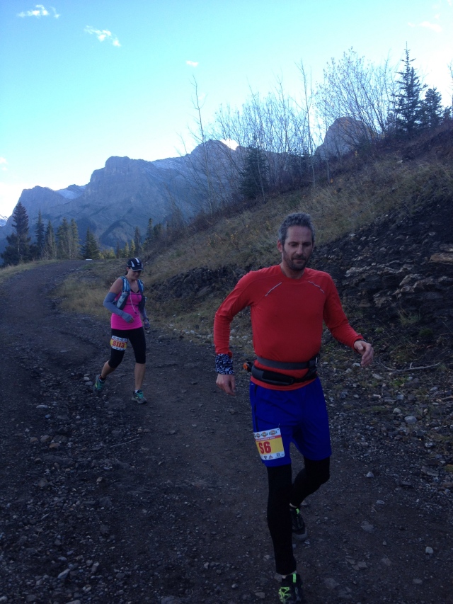
Above: Returning to the stadium after stage three.
Stage Four 7km 272m vertical gain
Stage 4 is short but starts with a 2 kilometer hill that gains 500 vertical feet! I bolted up it feeling great though I don’t think I was as fast as I felt. Almost as soon as it started it was over having completed it (with a bit of hobbling on the downhills) in just over an hour. The painkillers were definitely wearing off but now just one more 5km stage.
I came back to the stadium and did my routine and told Suzanne I’d be back in an hour!
Stage Five 6km 215m vertical gain
I left the stadium and the pain was getting pretty intense again but it didn’t even mater. I hobbled up the last big hill up to the meadow and saw the Bow Valley with the evening light on it. At this point I was all by myself on the trail and halfway done the 6km loop. I turned east for the last 3km home and got pretty choked up. Some joyful tears were added to my sweaty sleeves!
On top of the last hill with 200m down to the finish line. I could see and hear Suz cheering me in. I had a sense of lots of people cheering but my eyes couldn’t seem to focus very well. I heard Suz remind me of my goal to “finish with dignity” so I stretched out my stride and ran through the finishing line with the announcer calling me in. After 8 hours and 24 minutes, I did it.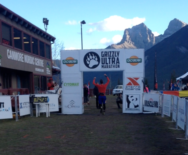
While I was training, I heard Canadian tennis star, Eugenie Bouchard say that “It’s hard to get beat if you never give up.” I said that to myself over and over on my training runs and a few times during the race. What I learned from this experience was how much everyone else helped me to complete this goal. You do all the training, but everyone else gets you over the line. From the cheers of support at the stadium to the runners on the course all pushing each other, I couldn’t imagine doing this alone.
As I discovered on Stage 3, the pain can be enough to beat you and when the challenges are hard enough, in fact Genie Bouchard is wrong. It’s really easy to get beat-even if you don’t give up. But with good people surrounding yourself, you at least give yourself a fighting chance.
 Above: Skiing up Burstall Pass with fantastic Mt Birdwood in background. One of my favourite valleys in every season.
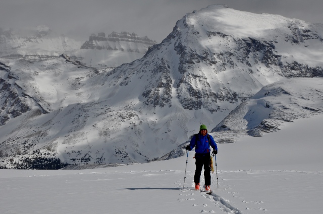
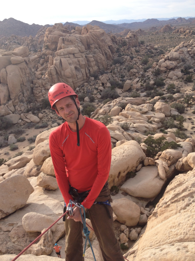
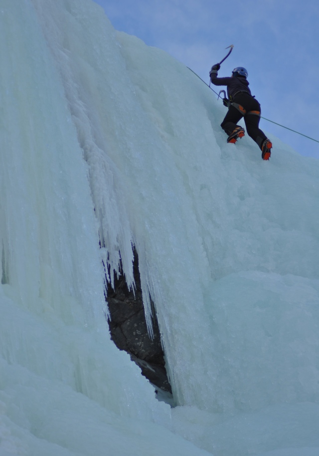 Above: Suzanne ice climbing on Grassi Falls.
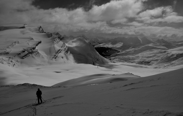 Above: Yoho Glacier on our way to summit of Mt Rhondda
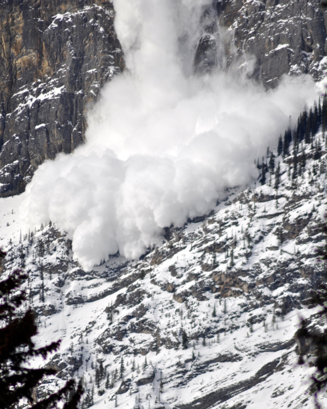 Above: Captured another good avalanche picture off Mt Rundle.
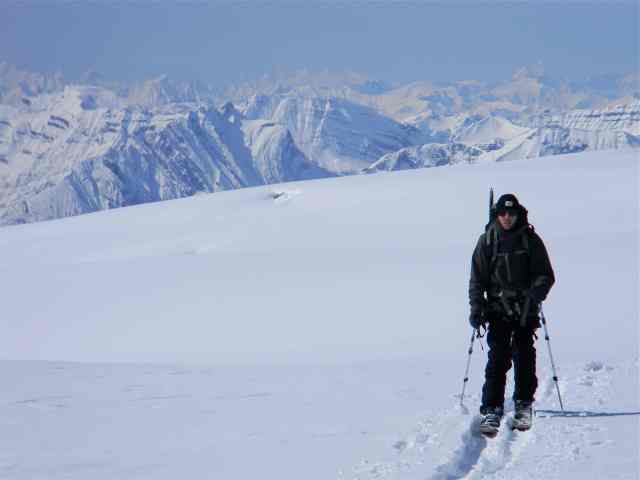
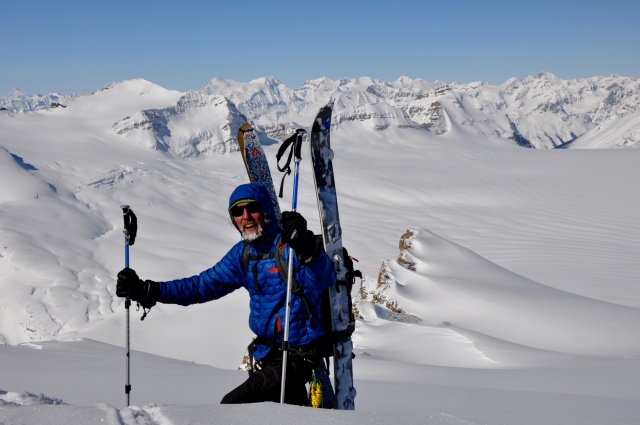 Above: Marc is just a few feet from summit of Mt Gordon. This was one of the best days I’ve had on the icefields with glorious visibility and breathtaking views. (skiing down was pretty good too!)
 Above: Late night, lunar halo over Vulture Peak on the Wapta Icefields. I lugged a tripod up the mountains on this trip and managed some great long exposure shots.
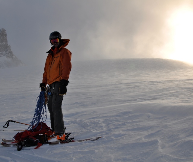 Above: Setting sun and the semi-permanent blizzard up on the Continental Divide. In less than ideal conditions I’m untangling some rope that has decided to be a crochet sample.
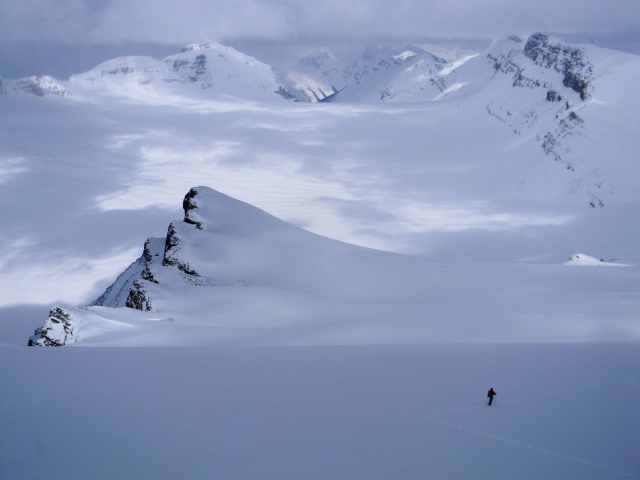
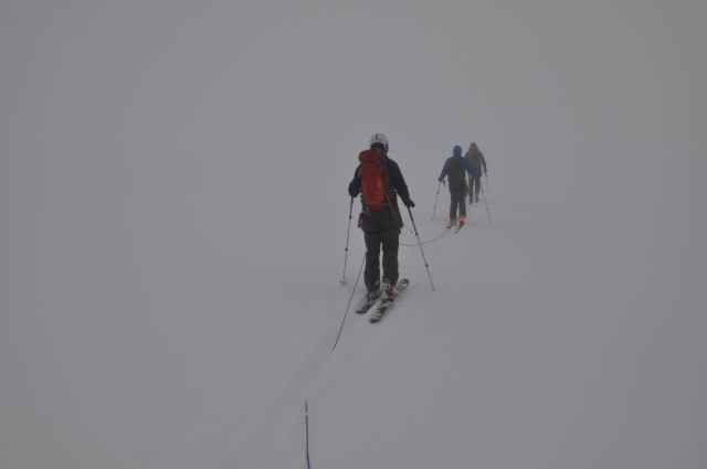
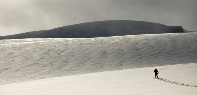
 Above: Traversing the expansive nothing on the roof of the Rockies.
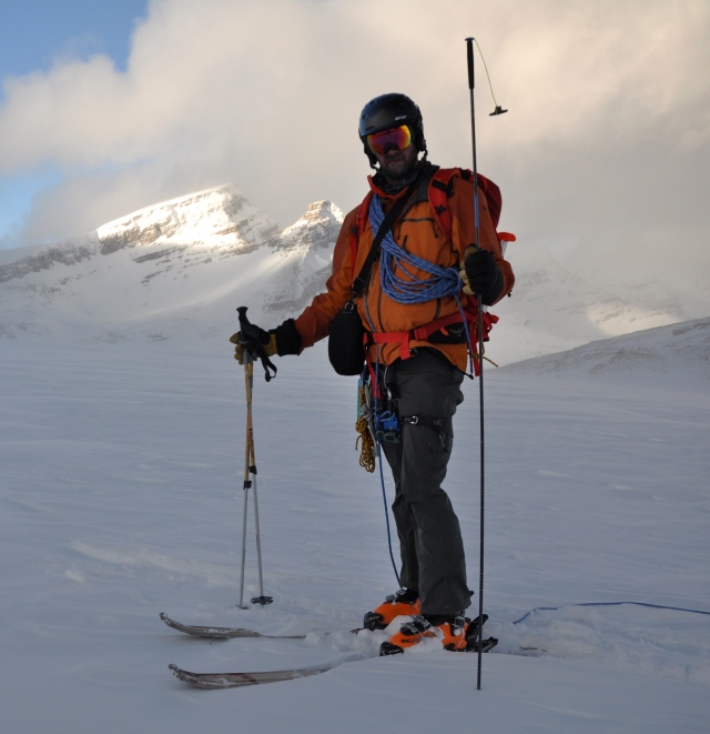
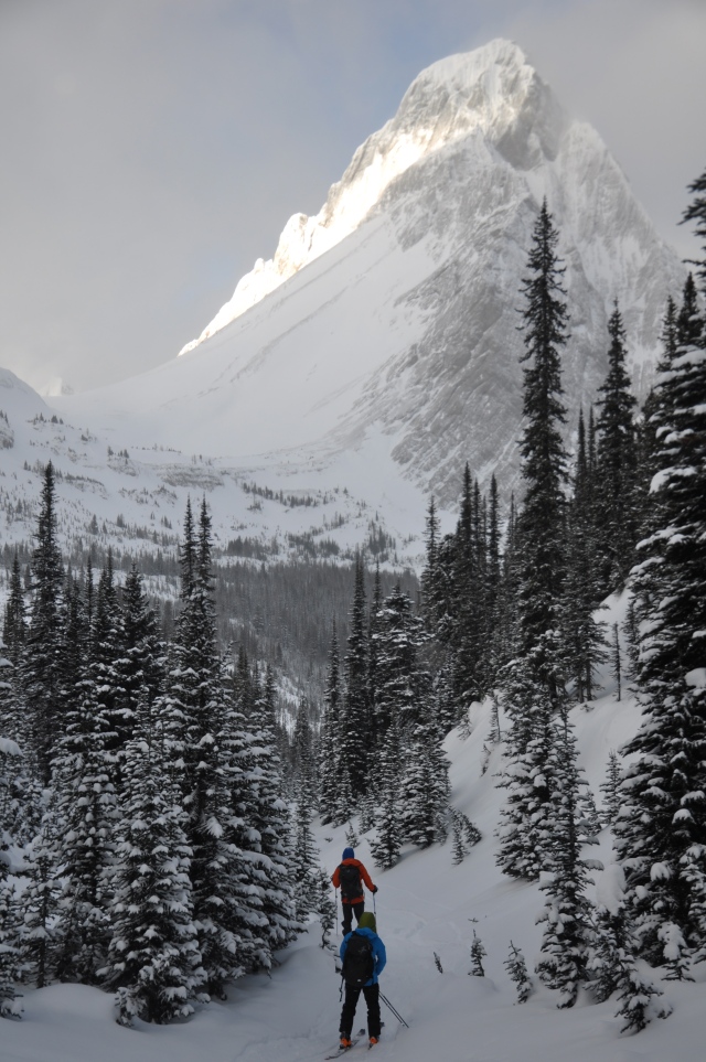
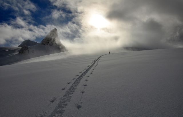
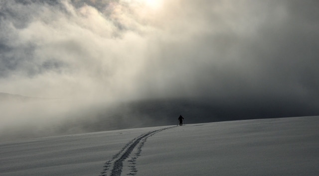
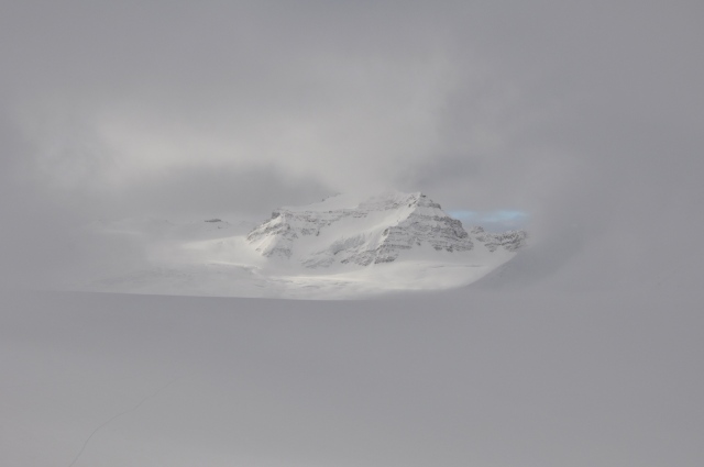 Above: Distant Mt Collie emerges from the fog like a dream.
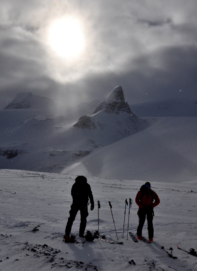
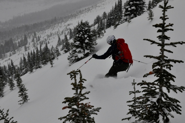
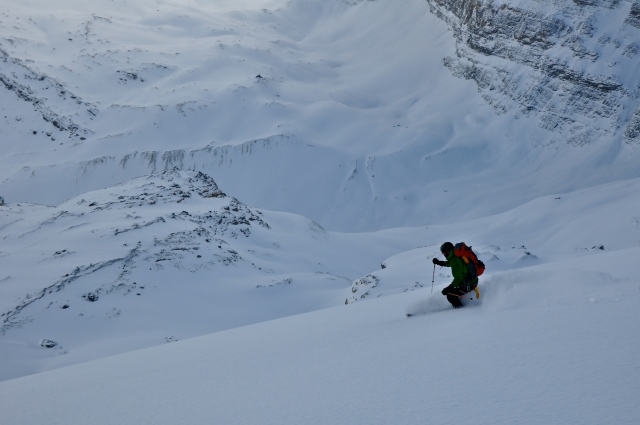 Above: As a consolation prize, we all skied miles of untracked powder all to ourselves. People pay thousands of dollars for guides and helicopters to take them to places like this. Years of hard work learning how to get to these places safely, and all the physical conditioning all pay off on days like this! The snow was so good, we climbed back up this section and skied it again finally returning to the hut very tired.
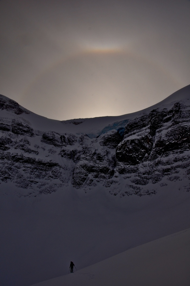


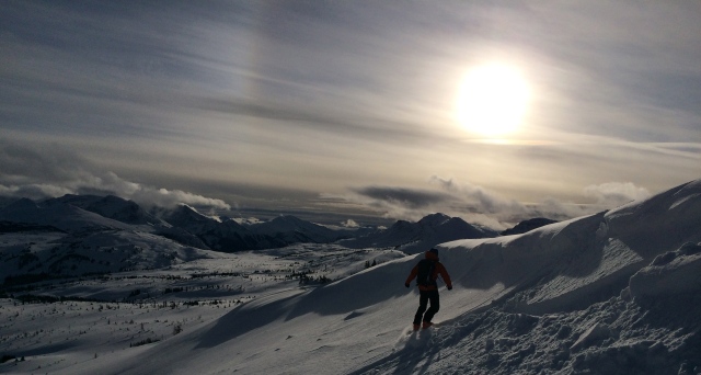
 Below is just beneath the summit looking west. It really feels as though you are on the roof of the world as the tops of the mountains lie beneath you stretching to the horizon.