I’m back home for a day or two from the north. Lots of interesting things but as I’m catching up on sleep before returning for another stint, I’ll just post one note. I was surveying all the riparian zones on our project (I get most of the work on foot as I’m the only one who enjoys it) when I traversed along this unnamed frozen lake. I did a bit of a double take when I realized there was a gorgeous rainbow halo on the ground in the snow!
It then occurred to me I have never seen a halo on the ground before. I took this picture with my iphone but of course the halo merely looks like a lens effect. It’s only an interesting picture if you understand that the halo exists in the world and not just the camera. Upon getting home yesterday, I looked up the phenomenon to discover it is very uncommon and could only find a handful of pictures of it. This is the more common 22 degree ground halo. There is an even rarer 42 degree halo as well.
Above: 22 degree ground halo taken 11am, Jan 18, 2015 @ lat. 55N
To create this halo, ice crystals need to form and settle in a very precise way. As I’m always saying, there’s always something new and astounding in the bush if you spend enough time out in it.
How many times we find ourselves saying, “How on earth did this happen?” I feel a bit of this as I contemplate a year of training for the 2015 Grizzly Ultra Marathon. For some reason last month, I bought an entrance into this event.
Looking back, I trace this madness to a poor showing running up Sulphur Mountain in late fall. I didn’t beat last year’s time and it kind of erked me. I doubled down on improving my endurance. On a big Saturday run with the Canmore Trail Culture crew I found myself at the back running with Suzanne’s co worker who had just finished a 160km race last month. We ran the same pace which gave me a sense that somehow extreme endurance running was not a mystical feat performed by demi-gods but by real people. It’s true, I would be exhausted in an hour and a half, and she could run that pace for 30 hours (really!) but somehow I felt as though a mental barrier had been breached.
And that is how I ended up where I am now, looking with some excitement and dread at the year ahead of endless miles, stretching, ice baths and soreness!
The “Grizzly Ultra” is an “easier” ultra marathon that takes place on October 12 2015 at the Nordic Centre. It is a trail course (as opposed to a road course on pavement) over some pretty hilly country. The 50km course has 4600 vertical feet of climbing.
Above: An elevation profile of the race. It’s pretty much a 10km race plus a full marathon with a 415 story building to climb up along the way!
Maintaining a training schedule over the next part of winter is difficult. My work days are long and out in the cold so when I get back to camp I have little energy to train. But I will try as best I can. My training goals for now are to stay uninjured while I slowly increase my endurance. In the spring, a more rigid mileage regime will begin in earnest when I am done winter work.
It is quite fortunate that I have so many inspiring people around here to keep me going when the task seems too hard. I know a half dozen other people in next year’s race so perhaps misery will indeed love company!
As the coordinator of the Banff Mountain Film Festival world tour, Suz spends most of her work time in the office. However, the festival did want her to go and see a few stops so she used that opportunity to carve out a short holiday in our new favorite place: southern Utah. She was going to festival stops in Golden, Colorado and Moab, Utah then have a couple days to go biking with me before flying back to Banff. I drove our bikes down and did some extra exploring.
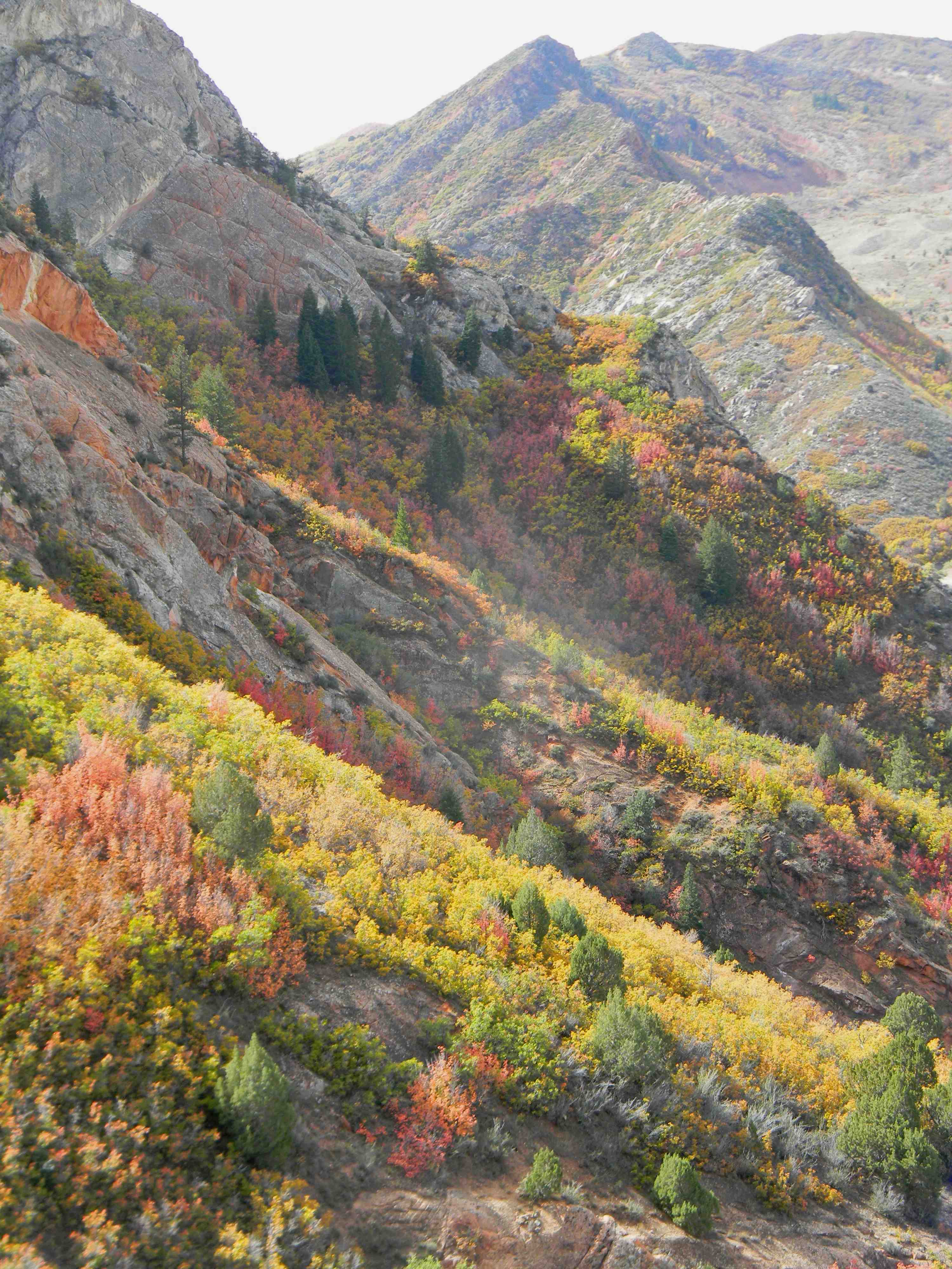
Above: Fall colours in southern Utah can hardly be believed. Not even my scratched lens can ruin this picture. These mountains near Price, Utah looked as though they had been covered in brightly coloured froot loops.
Above: Both southern Utah and Colorado were in peak colours. I usually think of eastern states and provinces when I think of beautiful fall colours, but combined with the brightly coloured desert rocks I was mesmerized.
Above: Sunset in Arches National Park outside Moab. I met Suz in Moab and while she was busy at the festival I went to a favorite spot outside of town for sunset. It was great this time around as I didn’t feel as though I was trying to see as much as possible. I had more of a lay of the land and spent more time just soaking up a few favorite places.
I returned to town and met the Moab hosts of the festival, one of whom was an avalanche professional so we talked snow pack for a while and I got some great information on Mt Peale, a towering mountain I was interested in climbing that week. You can see it for nearly 200km in any direction as it rises right off the desert plateau so we just went outside and he pointed out the ideal line to climb. It’s always fun talking to mountain fanatics.
Above: The next day, Suz and I biked the Klonzo trail system outside Moab. There was a major three day bike race around Moab organized by a guy in my running group. Luckily there are so many amazing places to ride in Moab it was hardly a problem. Our favorite trail was the aptly named “Wahoo” trail. We liked the helpful signage below. Suz has seen quite a few bike films this fall as she was vetting film submissions to the festival. I think they had quite the effect as I couldn’t get over how fast she seemed to go now! The long, rocky downhill on Wahoo is pretty exciting, all the more when you forget about the brakes as she seemed to! I was pretty impressed.
Above: After biking, we hiked up to Delicate Arch for sunset. We saw this from across the valley in the spring and wanted to see the famous landmark up close. Above: Suz leans into the wind returning from Delicate Arch. The ledge on this cliff looked straight out of a Wile E Coyote and Road Runner cartoon. There’s some good fake looking rocks near Canmore but this ledge was truly weird.
Above: Amazing sunset as we hike back from Delicate Arch back to the road.
We spent the evening in Moab and drove northeast to Fruita, Colorado the next morning. Some biking friends had told us we had to experience the mountain biking trails at Fruita.
Above: Suz bails on a technical section on the entrance to the “Horsethief Trail”. We later saw some riders on youtube flying down this famous trail with defying ease. Just after this section, we were racing at a pretty good clip into a sharp 90 degree turn leading straight down a rock wall. Suz was in front just flying and when I saw the massive rock drop in front without Suz anywhere to be seen, I only had time to think it must be okay and Suz must have rode it. But with another tenth of a second to take in the drop, I realized the rock face I was going straight down was too steep to stop so I was now comitted to something I would prefer not to do! I just pulled up the front tire and tried desparately to stay away from the instinct to brake. I sailed off the drop and landed with a puff of dust as another rider stood by having had the good sense to walk it. I caught up to Suz and we shared an adrenaline infused laugh exclaiming we have no business going over head-height drop offs but secretly wishing we had a picture of our Redbull moment!
Above: The Horsethief Trail follows nervously close to the Colorado River several hundred feet below which gives plently of fine views but requires some concentration.
While Moab is in many ways the epicenter of mountainbiking, we loved the trail system in Fruita for their flowy, fast nature. It’s also off the beaten track a bit more. The trail system connects to Moab via a multiday epic bike trail called the Kokepelli Trail but it’s a little more than we’re ready to bite off. We spent the night in Glenwood Springs, Colorado home of Doc Holiday and the largest hot springs pools in the world. The picture below isn’t mine but gives a sense of size of the place. A great way to soak out a few days of desert sand from our sore muscles.
Suz drove to Denver and flew home while I meandered around Colorado. I can’t say enough about the place. The mountains are not quite as raw as the Canadian Rockies and the valleys have more people in them which gives the place a more lived in feel. A little humanity gives the mountains a more inviting quality. I prefer the solitude and rawness of where I live but these mountains make a welcome change. I checked out Aspen, home of one of America’s more famous ski resorts. The ski lifts depart straight from town so the town and the hill are very connected. Our National Parks have such a strict limit to development that the ski hills in Alberta are very isolated and sparsely developed. For better or for worse but certainly they offer something that these American resorts do not which is a feeling of overwhelming isolation and vast natural wilderness.
I drove up Independence Pass which was an experience. A narrow road at times only one lane with only periodic guardrails to keep you from plumiting thousands of feet down. I spent most of the time in the left lane as I found the correct lane too scary! The top of the pass is over 12,000 feet high compared to 5000 feet for Roger’s Pass in Canada. I did a bit of scrambling up an easy peak nearby and found the altitude quite taxing. Down the road is the town of Leadville, Colorado at over 10,000 feet and home to the Leadville 100 mile race, a grueling, one hunderd mile foot race that traverses massive altitudes. I suited up and ran a miniscule 5km chunk of the 160km course just to appreciate the difficulty. Above: Colorado’s highest mountains rise to 14,000 feet as seen from near Independance Pass. The treeline is much higher here than at home so the mountains look much smaller here even though they are higher above sea level.
After exploring Colorado I was lured back to Utah for some hiking in Canyonlands National Park.
Above: I embarked on a big hike to Peekabo Springs. The flowing rock table land was cut into thousands of meandering canyons. If you were up on high, the various landforms made navigation relatively easy, but down in the canyons, it was a bit confusing. In spite of having a good topo map, it was quite easy to get turned around and I ended up on a bit of a 12 hour epic in the desert that added about 20km to my day.Above: “Newspaper Rock” a nearby rock outcrop covered with pictographs.
I really enjoyed the Canyonlands National Park Area. It’s off the beaten path so it sees fewer visitors. It lacks some of the iconic postcard landforms but is still spectacular. A perfect combination to experience fantastic desert sculpture without the throngs of people. Thirsting to see the Anasazi ruins I’ve seen in books, I headed east skirting Arizona and over to Mesa Verde.
The drive from the plain up to the plateau where the ruined fortresses are is an adventure. The road winds up over a thousand vertical feet to the top of the mesa where the famous cliff dwellings are hidden. Above is the first one I explored, the so called “Spruce Tree House” incorrectly named for the trees nearby which I noticed were actually firs! It’s a fascinating history but the short version is that in the 1200’s the villages were on top of the mesas but massive droughts caused shortages and strife with neighbours. They moved into these fortified hidden villages around this time before finally disappearing alltogether. The Mesa Verde site contains 600 cliff dwellings.Above: “Cliff Palace” is the most spectacular of the sites. The round pits are the unroofed living quarters.Above: After climbing a series of steps and ladders, I got to really explore the ruins. The alcove is massive with a cave roof like a modern stadium as the picture below shows. A magical place. There are many unexplained aspects to the story of the place that let the imagination run wild with speculation, an activity I found easy to engage in as I wandered through the many ruins. After spending the day going through a half dozen locations I spent the night in nearby Cortez, Colorado.My final must see spot was the geologically famous “Ship Rock” in nearby New Mexico. It’s on the Navajo nation which I found to be a bit depressing. The desert seemed to have an unwholesome quality to it, perhaps it was the weather.Anyway, I found my way to it by just driving at it. Theres little to no signage but you can see it for 50 miles in any direction as it’s an old volcanic neck rising 1500 feet out of an otherwise perfectly flat desert plain of nothing. After discovering it didn’t like having its picture taken I made my way out of New Mexico and back to the Utah desert.
I pointed the car north and made my way back home after another extraordinary time in the southwest. My taste of Colorado only wet my whistle and I’m looking forward to exploring it more next year.
Back in August, Suzanne sent me a notice of a new trail running group and suggested I check it out. I have gone to a few running groups over the last couple of years with varying success. A North Face sponsored group in Banff was very useful and fun but one I had tried in Canmore was more depressing than anything. The group was quite fast and after 15 minutes I was running by myself trying in vain to catch up.
The Canmore Trail Culture group, as it is called turned out to be quite different. My first time out, the run was on the “Loki” trail and was billed as an easy run on the trail for 45 minutes. While I did have to really push to keep up, Mike the organizer stopped the lead group at an intersection and organized a split of two different tempos. The two groups ended up going at their desired pace and everyone met back at the parking lot. I was struck with how hard he worked to make the different skill levels feel welcome.
Above: A typical evening run, this one up “G8” on the benchlands, involves plenty of ups and downs. Twice a week, Mike picks the trailhead and depending on who shows up, a plan is made on the spot to accommodate the skill level. Photo by Mike.
The rotating group of people range from a who’s who of Bow Valley athletes to recreationalists like me. I couldn’t help google a few names afterwards only to discover how many people were marathon winners, ultra marathoners, and enduro racers. Everyone chats while they run and the evening is a very social activity more than anything. I later learned that several people find running trails by themselves a bit scary which explained why these top flight runners would be out with novices like me. There is a difference between walking by myself, and running which I think can activate the chase reflex in cougars.
Above: This is my usual view as I am generally last in the line. On my own, I tend to not run very fast so I found this group just pushed my pace enough. As winter approached and the evenings grew darker and colder, the casual runners thinned out. Luckily, I had improved enough to be just able to keep up with those who remained.Above: Headlamps became the new normal as darkness slowly ate up our evenings. I really like trail running by headlamp. High-contrast tunnel vision makes for an exciting run over the mountains!
Above: A Saturday run in daylight. Usually Saturdays are adventure time with Suz, but in shoulder season, it isn’t decent weather for biking, skiing or hiking. Photo by Mike.
It has been an amazing experience having such high quality athletes to run with, but more than that, a very friendly and interesting group of people. Each week there’s a regular who has climbed something that week so we trade stories of where we went and what we saw. Someone is always at a race somewhere, or on a backpacking or bike trip, so there are never ending stories of the week’s adventures. The things people are working towards are pretty astounding. One regular has qualified for the Boston Marathon next year while another regular is training for the 5000km epic mountain bike race, the “Tour Divide” from Banff to Mexico! I can report that neither of them seem even remotely put upon by an hour and a half running up and down the mountains! Group leader Mike also seems indifferent to physical work which must have worked in his favour last summer at the Sinister 7 ultramarathon in the Cowsnest Pass. Sinister hardly describes this 161km race over the mountains! It’s so exciting to see what people are aspiring to.
It’s been really fantastic slowly extending how far I can run in the mountains. I was telling Suzanne the other day that it feels like I’m “cheating” somehow. Places that used to be far are now nearer. As if by magic. Thanks to this group, I managed a run up to Lake O’hara and back. And this week during the Banff Mountain Film Festival, I was inspired by climber Cedar Wright’s challenger to add some suffering to my week so I ran from Canmore to Banff via the Rundle Riverside trail. Total distance from here to the film festival location was 21kms. I had Suz stow some fresh clothes at the Banff Centre for me and after I changed clothes and walked in, I felt like I had stepped through a time portal and just appeared in Banff.
Next year my running goal is to do a circumnavigation of Mt Rundle which is slightly longer than a marathon. As well as a one day run to Mt Assiniboine and back which is a similar distance. Hopefully these goals will keep me training hard on the cold days when I’d rather be warm.
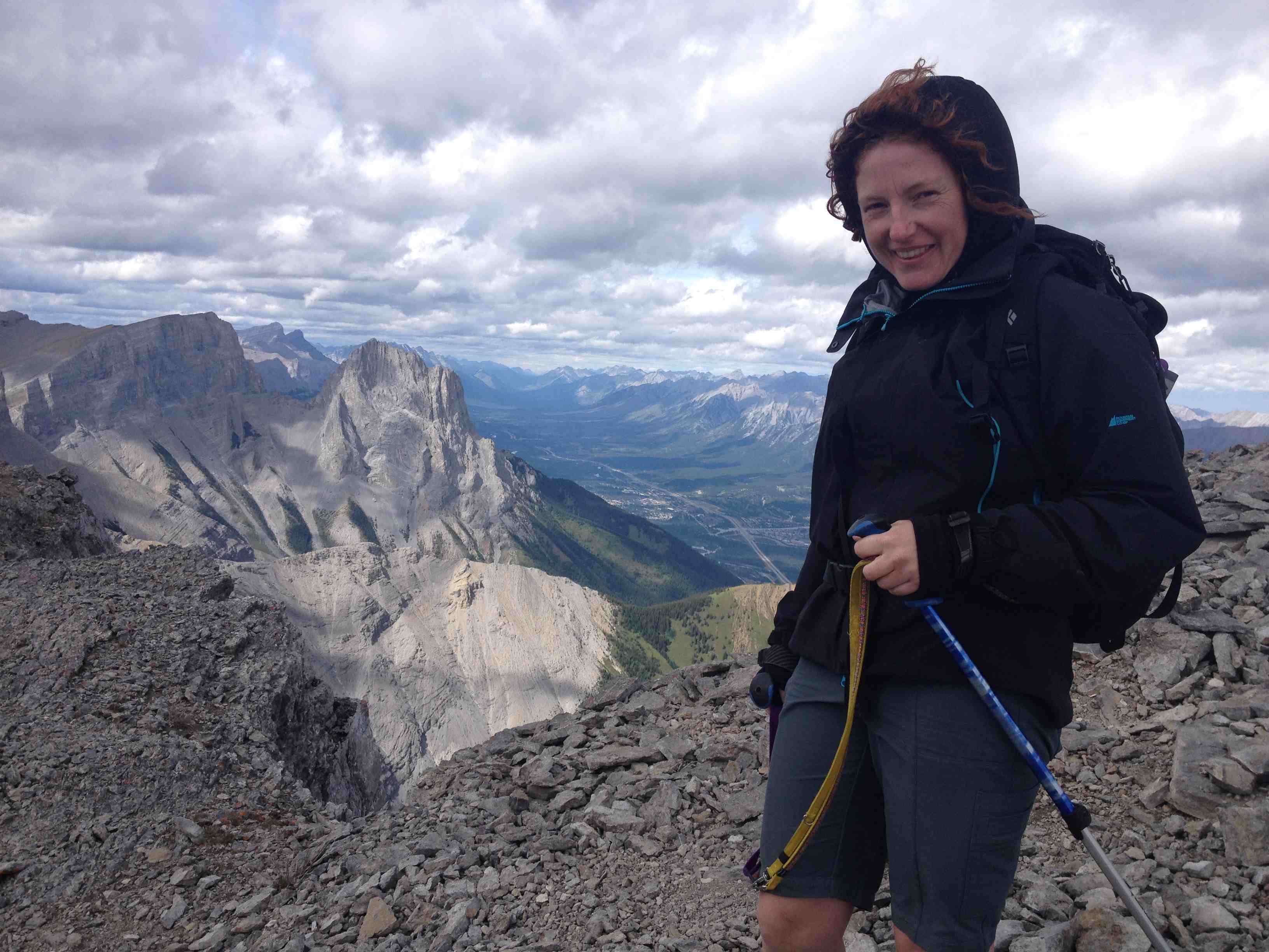
Great shot below capturing both Mike’s infectious spirit and a distant blurry me in red trying to keep up on this 1000m hill!
I thought I would throw down a shotgun spatter of fall activities.
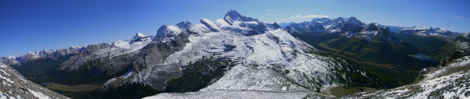
Above: A smokey view from Mt Cory. After crawling out of the bush my first thing was to make a return to Mt Cory. I had tried this one very early in my mountain endeavors and couldn’t find the correct ascent rib and got cliffed out. It was a small victory then to discover now how simple it seemed! Mostly an unpleasant climb and the heavy smoke from forest fires was a huge disincentive to keep going. A summit without a view is rarely worth it for me. In retrospect, this picture is kind of interesting with some unusual and subtle shades.
Above: Mt Lady MacDonald is a regular climb a couple times a season. An evening thunderstorm gave it a volcanic quality on this day. Suz and I brought sushi up for a mountaintop supper.
Above: Boom Lake. I’ve been trying to visit as many neglected lakes as I can. I combined this with a climb attempt of Mt Bell which rises off its flank. A very steep gully tested the nerves a little but most surprising was a visit from a hummingbird high up at treeline. I have never seen one in the Bow Valley before and this was not a place I expected to find one. It was hovering around some dying flowers in an old avalanche chute. I ended up not getting to the summit block but fine views were a good reward.
Above: Marc takes in the view on Frisby Ridge outside of Revelstoke. Suz and regular ski touring partners Hugo and Marc, and myself checked out this famous mountain bike trail in Revelstoke.
The trail is a real epic as it climbs over 2700 feet then follows the spine of a ridge with incredible views on each side. After a tough climb and fine rewards of a setting sun, we got to experience the thrill of the nearly 3000 foot descent back down the trail at breakneck speeds through twists and turns, big trees, rocks and rivers, and white knuckles! No without merit is this considered one of the premier trails in North America. We had a late supper in Revelstoke at 10pm and drove through the night getting back to Banff at 2am.
Above: September surprised us with an early snowfall. My traditional first snowfall hike is to hike up to Grassi Lakes with my camera. Even with a blanket of white, the lake retains its rich hues of green and blue. This spiderweb was a great discovery at the lower lake. After taking a hundred pictures of the same things I take pictures of from the previous years, I stop in at Larwence Grassi’s memorial plaque and read the inscription. “Master Trailmaker, He sought new paths, made rough places smooth, pointed the way to higher levels and loftier achievements.”
Above: I make an annual trip up the Mt Fairview’s summit. Usually I wait until the larches turn but I thought this year for a change I would see it green rather than orange. I picked a good high pressure day with clear blue sky. It’s one of my favorite spots in the Rockies as is evident from the large picture in our livingroom I took from this location. I couldn’t help but keep an eye on the time as I went up and noticed I could set a speed record if I picked up the pace. My only intention that day was to look at beautiful things but ended up sweating and gasping getting caught up in setting a best time! A grizzly bear on the way down gave the descent some interest.
Above: If the Mt Temple area is my favorite of the Rockies, this spot has to be my favorite in Kananaskis. Suz and I climbed up King Creek Ridge to get this stunning view of Mt Blane. We bashed our way up a steep, pathless slope and were greeted at the top by a heard of mountain sheep grazing peacefully. After drinking in the astounding views and taking too many pictures, we descended a pretty intimidating gully that was obviously the only way down into the next valley. Gorgeous alpine isolation but prime grizzly habitat had us keeping our wits about us. The exit was through the bottom of the King Creek Canyon, a Utah-like slot canyon that was a bit of a problem picking our way through the rapids, boulders and canyon walls. A great adventure into some stunning and seldom visited valleys. Below, Suz tops out on the ridge above the road before dropping into the next valley.
Above: Clouds lend an ethereal quality to the otherwise raw front range mountains. When a very old friend texted me that she was stopping in to Canmore, it didn’t take much convincing to get her to stay an extra day and climb a mountain. I suggested the Wintower as it’s close to Canmore with good views and not too stressful. Roberta is from Winnepeg and is in good shape for such flat country but started off so fast from the road she was amazed at how tired she was after a half hour. It was a reminder of how long it took me to learn how to correctly pace myself on big climbs. I explained she probably wasn’t in as bad of shape as she thought but just had to slow down for such a long haul. Self reproach and vows to spend more time on her bike was quickly replaced with “wows” as we neared the top. It’s so enjoyable to take people up to places like this as I get to appreciate them with new eyes.
Above: The Mt Chester area is always closed for Grizzly bears when I want to go there. On this day though, I got lucky and had a perfect day climbing up past the lake and up Fortress Peak. I’ve been to the Chester/Fortess Col before with lots of snow but was ill equipped to scale the very steep and snowy headwall. This time, I brought an ice axe and clawed my way to the top with a few pauses to collect my nerves. On the horizon is the Burstall Pass area which is a favorite spot for ski touring. From this vantage point is an incredible amount of space. Mt Chester in the middle takes on a volcanic quality as it seems so isolated from this unique vantage point.
Above: Suz and I finally checked out Goat Glacier, the closest glacier to Canmore. It’s a mere 5km away from town but kind of hidden and not that easy to get at. You can’t see it from any road or trail so it’s often out of mind. It’s really just a remnant glacier as it’s so low in elevation, most of it melted a thousand years ago though it’s left quite a trough of destruction which is quite raw and interesting. The larches were in their most golden prime which was a nice surprise.
Above: In order to visit the Lake Ohara region, you must book a spot on the shuttle bus that takes you up from the highway. Parks Canada controls the number of visitors through the limited shuttlebus. However, you are free to hike up the 13km road that gains a few thousand feet in elevation. I gave myself the challenge of running up the road, then running up the additional thousand feet and 10km trail to Lake McCarthur, taking some pictures then running all the way back down! It was quite a grind but all worth it as the lake is the finest I have ever seen. The picture above I think can back up what otherwise would be quite the claim. The lake is very, very deep which gives it a cerulean colour unseen anywhere. Added to this were some scattered larches still clinging to some firey colour. This really is a place to see slowly over a week, not in a crazy up and down epic but being an international destination, the shuttle bus is booked months in advance. For the dual quality of being astounding as well as the satisfaction of accomplishment, this really was the trip of the year.
The run up was filled with incredible beauty that deserved more time than I could give it. Next year I think Suz and I will try to get up here for a few days. We ski up here in the winter but summer is when the place is at its best. This trip also opened my eyes to the possibility of accessing distant places in a single day. I’m starting to exhaust many of the peaks and valleys within an easy drive of home. When I look for new places on the map, I find that they all involve multi-day efforts. With continued improvement, this trip seemed like finding a cheat card to get to all those far flung places in single day efforts. For next year, I already have a single day trip planned to Mt Assiniboine which is usually hiked in 3 days.
Above: Suz and I followed in the footsteps of a wolf pack on its way over the high pass at Shadow Lake. This year we decided to go “larching” in a new location. The larches can only be found at the highest elevations of the tree line so it’s always an adventure finding new locations. This year we went to often ignored Gibbon Pass. The approach involves a 12km mountain bike climb and then a substantial climb up a steep slope to get to a high alpine meadow. A cold and wind snap had left the larches less than perfect but it was an enjoyable trip with many surprises. The plateau above Gibbon Pass was a wild place. The remaining needles were mostly on the lower branched making it appear as those the ground was engulfed in fire.
The other side of the plateau drops down to Twin and Arnica Lakes via this needle encrusted trail. A “Wizard of Oz” quality makes this path hard not to follow. After running out of daytime, we made our way back to our bikes and prepared for the long, fast downhill run back to the road. Suz had been previewing many film entries to the Banff Mountain Film Festival and I think the biking films had some effect on her as I couldn’t believe how fast she was going down the slope! I ended up pushing my comfort level a bit to keep her occasionally in my sights as we bombed the run down through rocks and streams.
A fine September! I didn’t get up any 11,000ers which had been a goal of mine. Couldn’t organize with a climbing partner to tackle any of them during the proper weather but enjoyed smaller scale adventures just as much.
The summer work season followed on the heels of last season. Once again, we spent most of our time in the old burned area north of Slave Lake. By now, the undergrowth has become so dense that the logging company chose to herbicide large parts of the remaining areas to plant.
A huge challenge this year was just finding the cutblocks we were contracted to plant. By now trees that hadn’t been cut were burnt and fallen to the ground and covered with grass making the outlines very challenging to find by helicopter.
Above: Owner Cal, crew supervisor, Jen J and myself flying around with maps out trying to make sense of the world. Once you land, the underbrush obscures everything making it difficult to know where to get the helicopter to drop trees. I spent much of the summer with a nagging feeling of not being one hundred percent sure of where I was!
For our first camp of the year, we put our entire camp in a sea container during the winter and drove it into our first camp location on an ice road. Then in spring, we helicoptered in and set it up. The sea container then gets driven out next winter. We still have to fly camp out to our next location but it saves us from flying the camp in one way which is pretty expensive. The Bell212 we flew it out with runs 2,000 dollars an hour.
Above: Our first camp with our trusty sea container. Not a very picturesque place really. We’re on a forced day off as the helicopter can’t fly in the fog.
Above: I never remember finding so many eggs before. I could have eaten quite well off these. The brown eggs on each side are the eggs of the annoying Lesser Yellowlegs, a sandpiper that follows you around all day yelling like smoke detector. I nearly broke them out of spite.
Above: As complex as the boreal forest is, it has some governing characteristics. One is disturbance and dominance. Working this massive burnt area for a few years has been an interesting experience to see the waves of colonizers, adapters, infestations, die offs, and emergences. While the forest is in its transition phase, different things explode and monopolize their new opportunities. Incidental to these big scale transitions, it also happened to be a peak year for tent caterpillars. After they ate everything in sight and turned into moths, I watched a swarm of chickadees dogfighting them and devouring them! Chickadees always seemed cute before, but to see them hovering and hunting like attack helicopters, I had a new found respect for them. I’m fond of discovering that every year there is some new behavior and sight to see in the forest.
Needless to say the bugs are pretty bad. They seem to be worse in the burnt areas though I’m not sure why. Exposed skin was impossible. I wore socks with the toes cut out to cover the gap between my shirt cuffs and my gloves. The is no escape except in your tent but as my day starts at 5:30am and doesn’t finish untill 9pm, my tent is a mostly a far off vision in a long day filled with crawling black flies.
When the dragonflies come out, it becomes a reason to celebrate!
As much as the bugs can mentally take their toll on you, we’ve learned from experience to keep ourselves as entertained as best we can in the middle of nowhere. Every end of the shift is some kind of event planned in advance to keep spirits up. Some of these become annual events. Last year when the floods trapped us in Kananaskis, we celebrated “half christmas” on June 25th and it was such a hit we brought it back this year. On June 25, half way till Christmas, we all drew names from a hat and exchanged gifts such as we could muster under a poorly decorated tree. As tired as everyone was, the gifts were all as well thought out as they were appreciated and generated a few weepy eyes.
Above: Celebrating Half Christmas while a welcome breeze keeps the bugs at bay, a christmas miracle! Standing at far left with red shawl, Thunder smiles upon receiving a gift from Jon, wearing the white cap.
Above: Our annual costume party is legendary. Tim, dressed as a giant fly swatter, is chasing Joshua, dressed as a blackfly in a spirited performance piece! More than a chance to let off steam, these events occupy the mind during long hours of toil.
For the most part this year, the weather wasn’t as nasty as some years. A cold spring and warm summer would be the best description. A few storms conspired to make life difficult for me. At one point I had a large crew of 20 people flying deep into the bush during very uncertain conditions. On the first flight in, the pilot and I played cat and mouse with the fog to try and get in only to have him ask me if I thought we could get out. If I wanted him to, he would take the next loads of people in but possibly strand them there at the end of the day. It was a horrible decision to have to make with so little information. We dropped the crew I had on board into the blocks and flew around a bit trying to make a quick decision. Things seemed to be deteriorating and based on what weather was coming in, I didn’t think we could get out at the end of the day. We picked the crew up and returned to the forward staging area. Highballers don’t like missing days so I felt a lot of pressure to make the right call.
The next day came and we all flew in, had a massive day and just finished up as a huge storm came flying in. The last crew and myself waited with a bit of horror as the storm hit just as he returned. We threw ourselves in and pilot Colin pulled up before the door was even closed and fought the machine through the squall. A few strokes of lightning were dangerously close but after 5 minutes of putting the hammer down, we were in the clear and safely on our way back to the highway.
Above: An approaching storm complicates an already complex day with 20 people trying to finish 8 different heli blocks. Days like this are crazy, we woke very early and left at 6:30am and finished at 9pm and got back to camp at 10pm. Lots of complex logistics to keep everything running smoothly but when it all comes together, it’s a very satisfying feeling. Photo by Alani.
Above: There’s no feeling like the last day of the season! Thunder’s crew celebrates the last tree of the 5 million tree season season.
As is tradition, for the last night in camp, everyone dresses in formal wear for a really good supper together and for our awards show and variety night. We actually have rubbermaids filled with dresses and jackets and ties to pull this off. There’s something terribly ridiculous about seeing people who are normally covered in mud and sweat, in semi formal wear even if a bit creased!
Above: Matty takes the official picture of all the ladies dressed up. After a gourmet meal we give out a few awards to people both respectful or ridiculous. Then comes the variety night where people perform songs, poems, skits or performances they’ve been dreaming up all season.
Above: Our “camp man” Brandon, apart from being one the sharpest wits, is also a pretty effective stage designer for the middle of the bush! After living in the apocalyptic looking burn all summer, these living conifers looked to us like jewel encrusted pillars of a Persian palace. He went to great effort to find them and incorporate them into this masterpiece of light and shadow. The guitar player Jonas, is a young German travelling through Canada who was fortunate enough to bump into foreman Thunder who convinced him to plant trees with us. He was a natural and seemed impervious to hardship and suffering. Accompanying him is his fellow greenhorn, Emily who, while not obvious to herself at the start of the season, was also made of a stuff tough enough to withstand anything.
Above: Thunder reads a tree planting poem she wrote. I’m not sure what is more impressive, Brandon’s carved podium or Thunder’s gold lame outfit!
After the performances are done, the evening winds down with a dance party. It feels a bit like a very strange wedding. It’s hard to convey how much joy is expressed here, but after months of being away from home, in the middle of nowhere, going tired and thirsty through cold and heat, mud, bugs and every kind of frustration and exhaustion possible, the realization that we now get to reap the rewards creates an explosion of joy. From here we scatter to all corners of the world to do all sorts of exceptional things. Though perhaps after a long nap…
Yet another boogey man story from CBC suggesting that global warming is causing some Antarctic catastrophe. If you actually read the study though, it turns out that a computer model thinks that just one small portion of the West Antarctic Ice Sheet may increase its speed into the ocean in a thousand years. (CBC quotes the low guess of one hundred years but the study says it could be thousands!) That’s right, CBC goes from a wild guess by a computer over an irrelevant time period to catastrophe that is explicitly your fault. What is wrong with these people?
Above: Screen Capture from the CBC story which mentions observations but leaves out these observations were then fed into a computer model.
——————————————————————————————-
Meanwhile in the real world, the exact opposite of these claims is occurring.
Above: Satellites show long term cooling in Antarctica air temperatures!
Above: Long term cooling also seen in the ocean surrounding Antarctica see data source here Falsifies the claim that “warm water is eating the ice”
So the article claims warm air is warming the water which is melting the ice. Freely available observational data found in 2 minutes falsifies every single one of those claims. Air is cooling, water is cooling, ice is growing.
The disconnect between the scare stories generated by computers that might happen hundreds of years from now, and the actual conditions is staggering. Only in a world where CBC’s funding is taken from me without my consent, can they continue to live in such a fantasy world without repercussions.
Disgraceful. Every journalist that silently allows this continual nonsense to persist is quickly digging their own grave as the credibility that remains in this profession evaporates.
This article came my way from the Guardian and it’s a perfect example of so many similar stories that I see every week.
from the story:
“Climate change caused by humans has made the likelihood of extreme rainfall similar to that seen in England this winter significantly higher, according to analysis seen by the Guardian.”
It’s unfortunate for Fiona Harvey’s credibility and professionalism that I can spend a minute and a half on the internet to disprove this with observational data.
Above: data from the UK MET office. Observations shows no trend in rainfall
Below: data from the UK MET office. No increase in large rain events either.
What about the first part of that sentence?
Above: Central England Temperature data set shows no warming during peak precipitation months in winter.
So everything Fiona Harvey breathlessly declares in proven false by simple observation. She claims:
1) (human produced) CO2 is making it warmer
2) warmer makes bigger rainfall.
The above observational data shows neither of these to be the case.
So why does she write the story? For one, her interview subject is none other than Oxford University. I suppose that in the absence of any experience in science herself, Fiona assumes that a researcher from Oxford must surely know what they are talking about. At least that’s how I account for a lack of critical thinking skills. I guess J school is but a distant memory for her.
The problem arises in two simple words. “Reasearch shows…” In fact, the Oxford team is playing with a computer model. The result of a computer model run is not data nor is it an observation. A computer model result is a regurgitation of their theory. The model is programmed with a set of assumptions so the output is only as good as those assumptions. It doesn’t show you a new phenomenon and it’s not an experiment. If you don’t understand something complex like regional weather variations, a model will not help you predict anything. Computer climate models only work a few days out because actual climate involves sets of currently unsolvable equations like the Navier-Stokes smoothness equations. You would have thought that people who grew up in the computer era, would at least know how they work, what they can do, and what they can not do. My cell phone displays who is calling, provided I enter the contact info for that number. The phone can’t do that by itself. It’s pretty depressing that someone who works in a science field doesn’t seem to understand this. A climate model is more complex than my cell phone but the principle is exactly the same.
After interviewing the Oxford researchers, Fiona would have imagined herself to be pretty presumptuous to check their work. Except for the fact that it requires no science background to simply ask how the Oxford team tests their computer model to see if it is correct! As it turns out, their model has no validity test prompting a rational person to wonder why it is even in the newspaper in the first place? Now the Oxford team will claim it’s been tested, but if there is a process they don’t understand or know about, then the output will be incorrect. Claiming any validity test is to claim they know all unknowns. The fact that weather forecasts are only good for a few days is proof of the complexity of the problem. Climate modelers will say what they do is different but they can’t get around the fact that we don’t understand the processess, and what we do understand involves solving unsolvable equations. Mathematician Chris Essex says you have to believe six impossible things before breakfast to take climate models seriously.
I hope, but I don’t expect a journalist to undestand good science from bad. But the most basic questions are missing here. Why should I believe the model? Is it actually warmer in the UK? Is it getting wetter if it is indeed getting warmer? Is one causing the other?If it’s true, how do you know this isn’t natural? Luckily, I live in an age where I don’t need to trust Fiona, I can check these things myself in a mere minutes.
Looking at the data above, there is no correlation between warmer years and wetter years, and it’s not getting warmer in the UK, and it’s not getting wetter in the UK. The last obvious question is whether Fiona is
a) lazy and couldn’t be bothered to fact check her assumptions.
b) time pressed and had no time to fact check her assumptions.
In other journalism subjects neither of these would be acceptable conduct. Now I realize that the place to question the Oxford researchers is from an editorial perspective, not a reporting piece. However, given that made up assertions are used in lieu of readily available facts, it seems that this is an editorial, just disguised as a report. Fiona can’t excuse herself by claiming “I only reported what they told me” She can believe this only if she thinks there is no responsibility to report facts. I see this constantly in climate reporting where otherwise arcane postulations of researchers are unwittingly passed off as facts with made up nonsense rounding out the story. This is the mold the CBC uses in their countless, baseless, scare stories. When a story has no consequences to the reader, I can be more generous but when no one fact checks a catastrophic prediction, you’ve made yourself a moral agent in its dissemination. Once upon a time you were not alowed to falsely yell fire in a crowded theatre. Yes, budgets and deadlines are tight, but the observations that falsify this story were found in a minute.
Meanwhile in the real world, the RSS satellite temperature data set was updated this week for the month of April. As always, the media treats real data like the plague.
Above: No relationship between CO2 and global temperture in the 21st century. Surely there is a climate story in there?
Here is a science lesson for Fiona. If you think phenomenon A is caused by B, plot one against the other to see if there is a correlation. Then investigate whether that correlation implies causation or whether some else could have caused phenomenon A. In the graph above we have CO2 compared with global temperatures. At higher CO2 levels, there is no commensurate increase in temperatures. Never mind causation, we don’t even see correlation! Why did Fiona not ask the Oxford researchers about this. Why didn’t she take the 55 seconds to pull up some temp and precip numbers for the UK before or after her interview? Surely just a minute of research would allow her to ask the right questions at the very least.
Like I said, you don’t need to be a scientist to write about this stuff. But you do need to be a journalist.
The “Glacier Skywalk” opened today along the Icefields Parkway. It’s a viewpoint built along the highway overhanging the Sunwapta Canyon. (see brief below)
Critics of the Skywalk got plenty of airtime on CBC. While they are entitled to their opposition, I suggest they understand very little of this area. The biggest degradation of this area is not the viewpoint but the road itself. The road alters predator prey relationships, animal movement, hydrology and introduces people and noise into an area that would otherwise see none but a few dedicated climbers. People who oppose the skywalk don’t seem to mind using the road to look at these landscapes. And therein lies my beef. They overlook the biggest sin because they use it, but are up in arms over the smallest of sins they have no intention of using. If you are going to oppose the skywalk, then logically if you really cared about the natural environment, the road itself ought to be your highest priority to eliminate!
That 230 km road could disappear tomorrow for all I care. It would be a wonderful luxury to stand on Mt Wilcox in August without hearing the distant roar of motorcycles plying up the highway stressing out animals and destroying the solitude. On the other hand, the Skywalk’s additional presence will be completely unnoticed.
The people who oppose the skywalk along with 99 percent of the population lacks the knowledge, skill or fitness to travel even 100m away from the road and into the vast protected landscapes on either side. That isn’t going to change anytime soon. If the point of the parks is to have preserved land free of human influence, the vast majority of the parks already enjoy this by virtue of the fact that so few can actually venture beyond the highway. If the purpose is for people to get the opportunity to enjoy in a low impact way the landscape in the park, then this viewpoint does that in spades.
It reminds me of local Canmore residents who recently opposed a residential development project on the grounds that it would be harmful to the environment. It never seemed to occur to them that they themselves and their own houses could fall under similar objections!
No, the Icefields Parkway is yet another example of environmental exceptionalism. It’s okay to pave a swath and usher in millions of cars and people through a pristine area, but heaven forbid you build a highway overlook! Sorry, but the real damage was already done. I have no interest in the Skywalk myself. My interest in this area is to climb and explore, but there are many ways to enjoy these spaces. If something comes along that is worse than the road itself, then I will oppose it.
Below: The world just a kilometer beyond and a 1000m vertical up from the new glacier skywalk. Pristine as ever! Perhaps if the environmentalists weren’t such city-folk, they would see how little the skywalk changes anything in these parts.
By chance, Emil, one of our old trip partners (now living in Whistler) had a few days off and came back to Banff. He was one of the four others I did the Wapta Traverse with so the entire Wapta alumni all got together at the Bear Street Tavern in Banff for a reunion. Everyone had good news to catch up on but the talk soon drifted to doing a trip while he was here. Randy and Peggy had obligations with their new baby so Hugo and Emil and myself planned a quick adventure. I suggested a one day marathon of starting in the Spray Valley, climbing up the French Glacier, skiing across the Haig Glacier and climbing up to the Robertson Glacier and skiing back out to complete a circuit. After some planning and research that evening, Hugo and Emil picked me up at 6:30am from Canmore. We headed south 45km into Kananaskis Country and set off.Above: Emil negotiates a creek early in the morning dawn. The avalanche conditions were quite good and the weather looked perfect with blue skies. The only tricky part besides the long distance was the climb from the Haig Glacier up a very steep 500 foot wall to gain the Robertson Glacier. We brought crampons and ice axes for this pitch. This wall is south facing so there is a danger that the sun could make the slope very unstable by the time we would get there. We discussed the possibility of having to turn around here if conditions were unstable. Above: Emil climbing the French Glacier. This glacier is very small, with no crevasses and deep snow cover so we are climbing unroped. As always on trips that contain a very difficult crux, I spent plenty of time worrying beforehand. The wall is so steep that if you fell, you wouldn’t stop without an axe and the skills to arrest a fall. On the long climb up the first glacier I couldn’t stop focusing on it. I still need to work on fear management. On the one hand it makes me think of every tiny detail of what could go wrong and how to avoid every kind of danger. Fear keeps me safe. On the other hand, it sometimes robs me the enjoyment of where I am. Emil offered some good encouraging words along the way. I don’t want to have a lack of fear, but I’d like to be able to be mindful of what can go wrong, take action and then compartmentalize it better. Perhaps that’s one of the many challenges that keeps me putting myself in these situations. Above: Hugo climbing up the French Glacier. Hugo has been working hard as a new electrician and hasn’t had as much time to be active. This 3200ft vertical gain was getting the best of him and certainly it was a testament to him that he powered up it in spite of his work taking a toll on his fitness. At least when the weather is beautiful, hardships are easier to bear. A blizzard can really sap the strength from you even though the distance and elevation are the same. Above: On the second glacier, the Haig Glacier, we take a short rest for food, water, and getting our glacier safety gear on. I love being on these high altitude glacier plateaus. No trees or life of any kind and the mountain tops jut out so sharply. It’s just unlike everywhere else in the mountains. The sun was strong but the snow had yet to rise in temperature so we still had a good window of stability for the big wall. Above: Skiing across the flat Haig Glacier on our way to the Robertson/ Sir Douglas Col. In the valley (center of picture) I could just make out the Northover Ridge that Mike and I had explored a few years earlier. It’s always interesting to see old haunts from new perspectives. Below: From Northover (in August) you can see the Haig Glacier. The wall forming the saddle between the two big peaks (on the left and center of picture) was the crux. If you had told me when I took this picture that I would be climbing up that, I would have argued not in this lifetime! Above: We finally arrive at the crux wall. Emil studies it looking for the safest line. It didn’t seem so bad now that I was looking at it rather than wondering and worrying about it. After a short conference, we took our skis off, attached them to our packs and got out the ice axes. The snow quality was such that we wouldn’t need crampons. I couldn’t wait to get to the top. Conditions were safe but getting less so as the day went on. At that elevation and kicking up the steep pitch, it was very tiring but I found myself feeling very comfortable with my axe. The ice climbing course definitely increased my comfort level but I couldn’t call that climb enjoyable! Above: Last few steps at the top. Just a few steps behind me is a 50 story drop off but the white of the snow and the lack of any objects for scale or differentiation makes it nearly invisible. Only the sudden appearance of my tracks gives any hint! The view from the top was really incredible. I often see pictures from trip reports where the sky is blue and you can see what you are doing and I harbour a bit of a grudge from many trips with white-out navigations and half seen vistas. But today, we earned some perfect weather. We had a big three-way hug at the top and enjoyed some peak identification and snacks. Above: Success! Having won our elevation we got to enjoy dropping on to the Robertson Glacier for a massive downhill run in perfect powder. The release of safely getting past the crux combined with the joy of powder skiing in the backcountry had me laughing as I carved my turns down the big face. Above: Making turns down a section of Robertson Glacier. A few thousand feet down and we were in the Burstal Valley with a further 5km ski to join the Spray Valley and the road. A very long day with lots of elevation made us pretty glad to get back to the car! An amazing trip and as always, with great people. Quite a change from Utah and California!